Geolocate

Dexter topographic map

Click on the map to display elevation.

About this map

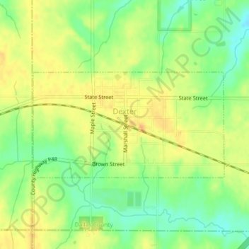
Name: Dexter topographic map, elevation, terrain.

Location: Dexter, Dallas County, Iowa, United States (41.50937 -94.24150 41.52082 -94.21383)

Average elevation: 343 m

Minimum elevation: 324 m

Maximum elevation: 357 m

Gear up for your next adventure:

🥾Trekking Poles - Adjustable trekking poles to reduce knee stress and improve stability
🎒Hiking Backpack - Lightweight and ergonomic backpacks for day hikes or multi-day treks
🧥Packable Rain Jacket - Breathable waterproof layer for unpredictable weather
🥾Hiking Shoes - Durable and comfortable shoes for trail hiking
🕶️Polarized Sunglasses - Reduces glare from snow and water at high elevations

As an Amazon Associate, this site earns from qualifying purchases at no extra cost to you.