
Anorí topographic map
Interactive map
Click on the map to display elevation.
About this map
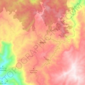
Name: Anorí topographic map, elevation, terrain.
Location: Anorí, Nordeste, Antioquia, Colombia (7.03361 -75.18664 7.11361 -75.10664)
Average elevation: 1,532 m
Minimum elevation: 925 m
Maximum elevation: 1,858 m