
Thank you for supporting this site ❤️
Make a donation
Make a donation
Gear up for your next adventure:
As an Amazon Associate, this site earns from qualifying purchases at no extra cost to you.
Entilibon topographic map
Click on the map to display elevation.
Thank you for supporting this site ❤️
Make a donation
Make a donation
Gear up for your next adventure:
As an Amazon Associate, this site earns from qualifying purchases at no extra cost to you.
About this map
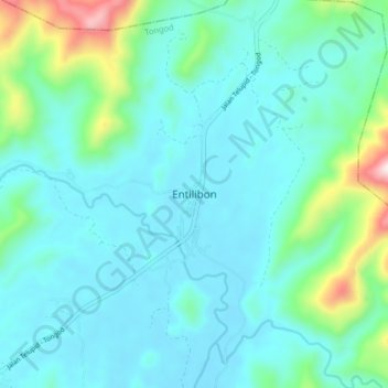
Name: Entilibon topographic map, elevation, terrain.
Location: Entilibon, Tongod, Sandakan Division, Sabah, Malaysia (5.49665 117.00661 5.57665 117.08661)
Average elevation: 189 m
Minimum elevation: 61 m
Maximum elevation: 825 m
Thank you for supporting this site ❤️
Make a donation
Make a donation
Gear up for your next adventure:
As an Amazon Associate, this site earns from qualifying purchases at no extra cost to you.