
Thank you for supporting this site ❤️
Make a donation
Make a donation
Gear up for your next adventure:
As an Amazon Associate, this site earns from qualifying purchases at no extra cost to you.
Sept-Îles topographic map
Click on the map to display elevation.
Thank you for supporting this site ❤️
Make a donation
Make a donation
Gear up for your next adventure:
As an Amazon Associate, this site earns from qualifying purchases at no extra cost to you.
About this map
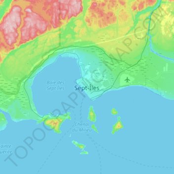
Name: Sept-Îles topographic map, elevation, terrain.
Location: Sept-Îles, Sept-Rivières, Côte-Nord, Quebec, G4R 1X5, Canada (50.05096 -66.53906 50.37096 -66.21906)
Average elevation: 65 m
Minimum elevation: -5 m
Maximum elevation: 421 m
Sept-Rivières trails, hiking, mountain biking, running and outdoor activities
Thank you for supporting this site ❤️
Make a donation
Make a donation
Gear up for your next adventure:
As an Amazon Associate, this site earns from qualifying purchases at no extra cost to you.
Other topographic maps
Click on a map to view its topography, its elevation and its terrain.