Geolocate

Mannodden topographic map

Click on the map to display elevation.

About this map

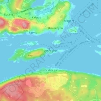
Name: Mannodden topographic map, elevation, terrain.

Location: Mannodden, Kragerø, Telemark, 3770, Norway (58.83783 9.38008 58.87783 9.42008)

Average elevation: 35 m

Minimum elevation: -1 m

Maximum elevation: 140 m

Gear up for your next adventure:

🔋Lithium AA Batteries - Long-lasting power that performs in extreme cold
🎒Backpack Rain Cover - External shield to keep your entire pack dry
🧴Insect Repellent - Protect yourself from bugs during outdoor adventures
🛌Down Sleeping Bag - Superior warmth-to-weight ratio for cold nights
🧰Multitool Knife - Compact and versatile tool for outdoor use

As an Amazon Associate, this site earns from qualifying purchases at no extra cost to you.