Geolocate

Wallberg topographic map

Click on the map to display elevation.

Wallberg

Der Anstieg von der Wallbergbahn-Talstation bei Rottach-Egern führt über einen Sattel links vorbei am Setzberg (1706 m) zur Bergstation der Wallbergbahn. Das dortige Panoramarestaurant Wallberg liegt in 1623 m Höhe. Nach weiteren 100 Höhenmetern erreicht man über einen Geröll- und Felspfad in etwa 20–30 Minuten den Gipfel mit dem Gipfelkreuz in 1722 m Höhe.

Wikipedia (CC-BY-SA 3.0)

About this map

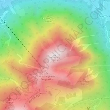
Name: Wallberg topographic map, elevation, terrain.

Location: Wallberg, Rottach-Egern, Landkreis Miesbach, Bayern, 83700, Deutschland (47.66583 11.79670 47.66593 11.79680)

Average elevation: 1,215 m

Minimum elevation: 747 m

Maximum elevation: 1,697 m

Gear up for your next adventure:

💧Filtered Water Bottle - Safe drinking water on the go
🥽Outdoor Goggles - Protective eyewear for outdoor activities
🧦Merino Wool Socks - Moisture-wicking comfort for long-distance hiking
🧭Orienteering Kit - Tools for map reading and navigation in the wild
🥾Durable Hiking Shoes - Long-lasting shoes for frequent hiking

As an Amazon Associate, this site earns from qualifying purchases at no extra cost to you.