
Thank you for supporting this site ❤️
Make a donation
Make a donation
Gear up for your next adventure:
As an Amazon Associate, this site earns from qualifying purchases at no extra cost to you.
Dhāri topographic map
Click on the map to display elevation.
Thank you for supporting this site ❤️
Make a donation
Make a donation
Gear up for your next adventure:
As an Amazon Associate, this site earns from qualifying purchases at no extra cost to you.
About this map
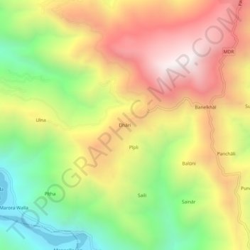
Name: Dhāri topographic map, elevation, terrain.
Location: Dhāri, Pauri, Pauri Garhwal, Uttarakhand, 246175, India (29.97667 78.64778 30.01667 78.68778)
Average elevation: 1,145 m
Minimum elevation: 499 m
Maximum elevation: 1,788 m
Thank you for supporting this site ❤️
Make a donation
Make a donation
Gear up for your next adventure:
As an Amazon Associate, this site earns from qualifying purchases at no extra cost to you.