
Riad topographic map
Interactive map
Click on the map to display elevation.
About this map
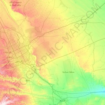
Name: Riad topographic map, elevation, terrain.
Location: Riad, Al Malaz, Provinz Riad, Saudi-Arabien (24.22004 46.31679 25.26728 47.74305)
Average elevation: 658 m
Minimum elevation: 414 m
Maximum elevation: 1,079 m
Das Stadtgebiet hat eine Fläche von 1.554 Quadratkilometern, das entspricht etwa der Fläche Groß-Londons. Die Umgebung von Riad ist topographisch sehr vielfältig. Erwähnt sei die im Nordwesten befindliche Abbruchkante Jebel Tuwaiq sowie die Dana-Wüste, ein im Osten liegender Sanddünenstreifen.