Geolocate

Matala topographic map

Click on the map to display elevation.

About this map

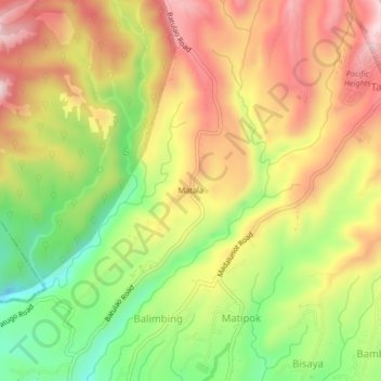
Name: Matala topographic map, elevation, terrain.

Location: Matala, Calaca, Batangas, Calabarzon, Philippines (14.00650 120.81405 14.04650 120.85405)

Average elevation: 403 m

Minimum elevation: 208 m

Maximum elevation: 580 m

Gear up for your next adventure:

🧥Thermal Fleece Jacket - Versatile insulation for changing mountain temperatures
Lightweight Backpacking Tent - Compact tent for efficient hiking trips
🥫Freeze-Dried Meals - Lightweight, high-calorie nutrition for multi-day treks
🧦Hiking Liner Socks - Thin base layer to prevent friction and blisters
🧭GPS Handheld Device - Reliable GPS navigation for outdoor adventures

As an Amazon Associate, this site earns from qualifying purchases at no extra cost to you.