
Thank you for supporting this site ❤️
Make a donation
Make a donation
Gear up for your next adventure:
As an Amazon Associate, this site earns from qualifying purchases at no extra cost to you.
Simara topographic map
Click on the map to display elevation.
Thank you for supporting this site ❤️
Make a donation
Make a donation
Gear up for your next adventure:
As an Amazon Associate, this site earns from qualifying purchases at no extra cost to you.
About this map
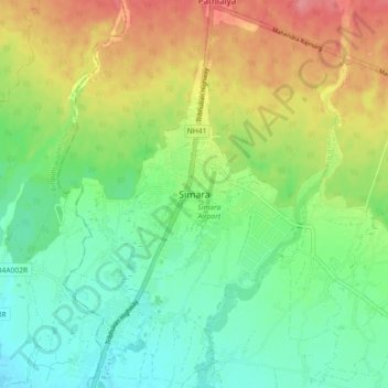
Name: Simara topographic map, elevation, terrain.
Location: Simara, Jitpur Simara, Bara, Madhesh Province, 44417, Nepal (27.12041 84.93658 27.20041 85.01658)
Average elevation: 134 m
Minimum elevation: 103 m
Maximum elevation: 180 m
Thank you for supporting this site ❤️
Make a donation
Make a donation
Gear up for your next adventure:
As an Amazon Associate, this site earns from qualifying purchases at no extra cost to you.