Geolocate

Jekulo topographic map

Click on the map to display elevation.

About this map

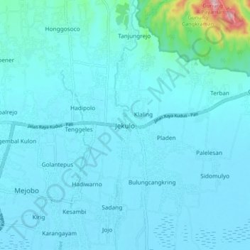
Name: Jekulo topographic map, elevation, terrain.

Location: Jekulo, Kudus, Central Java, Java, 59322, Indonesia (-6.84581 110.87726 -6.76581 110.95726)

Average elevation: 31 m

Minimum elevation: 4 m

Maximum elevation: 338 m

Gear up for your next adventure:

🛌Insulated Sleeping Pad - Critical thermal barrier between you and the cold ground
🕯️Camping Lantern - Illuminates your entire campsite with high-efficiency LEDs
🧶550 Survival Paracord - Versatile utility cord for emergency repairs and rigging
🧴Sunscreen SPF - Broad-spectrum sunscreen for outdoor activities
Lightweight Backpacking Tent - Compact tent for efficient hiking trips

As an Amazon Associate, this site earns from qualifying purchases at no extra cost to you.