
Thank you for supporting this site ❤️
Make a donation
Make a donation
Gear up for your next adventure:
As an Amazon Associate, this site earns from qualifying purchases at no extra cost to you.
Gostiuns topographic map
Click on the map to display elevation.
Thank you for supporting this site ❤️
Make a donation
Make a donation
Gear up for your next adventure:
As an Amazon Associate, this site earns from qualifying purchases at no extra cost to you.
About this map
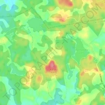
Name: Gostiuns topographic map, elevation, terrain.
Location: Gostiuns, Ezernieku pagasts, Krāslavas novads, Latvia (56.21028 27.56694 56.25028 27.60694)
Average elevation: 216 m
Minimum elevation: 186 m
Maximum elevation: 264 m
Thank you for supporting this site ❤️
Make a donation
Make a donation
Gear up for your next adventure:
As an Amazon Associate, this site earns from qualifying purchases at no extra cost to you.