Geolocate

Cipasung topographic map

Click on the map to display elevation.

About this map

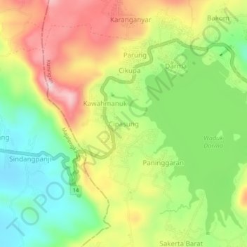
Name: Cipasung topographic map, elevation, terrain.

Location: Cipasung, Kuningan, West Java, Java, 45562, Indonesia (-7.03525 108.37613 -6.99525 108.41613)

Average elevation: 719 m

Minimum elevation: 580 m

Maximum elevation: 886 m

Other topographic maps

Click on a map to view its topography, its elevation and its terrain.

Gear up for your next adventure:

🏕️Camping Hammock - Integrated protection for sleeping between trees
🥾Hiking Boots - Sturdy boots providing ankle support and traction on rugged trails
🧴Sunscreen SPF - Broad-spectrum sunscreen for outdoor activities
🔨Vehicle Emergency Tool - Safety tool for remote road trips to trailheads
📷Outdoor Action Camera - Capture high-elevation views and rugged adventures

As an Amazon Associate, this site earns from qualifying purchases at no extra cost to you.