
Make a donation
Gear up for your next adventure:
As an Amazon Associate, this site earns from qualifying purchases at no extra cost to you.
Anthem topographic map
Click on the map to display elevation.
Make a donation
Gear up for your next adventure:
As an Amazon Associate, this site earns from qualifying purchases at no extra cost to you.
Anthem
Anthem is built on 5,856 acres (9.2 sq mi) at the base of Daisy Mountain and Gavilan Peak. The community's elevation ranges from 1,760 feet to 2,428 feet, with an average elevation of 1,863 feet. Approximately 36 percent of the community is preserved as open space, including 291 acres of open hillside.
Make a donation
Gear up for your next adventure:
As an Amazon Associate, this site earns from qualifying purchases at no extra cost to you.
About this map
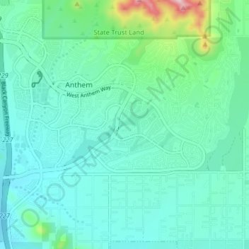
Name: Anthem topographic map, elevation, terrain.
Location: Anthem, Maricopa County, Arizona, United States (33.82719 -112.14685 33.87839 -112.08264)
Average elevation: 580 m
Minimum elevation: 521 m
Maximum elevation: 856 m
Make a donation
Gear up for your next adventure:
As an Amazon Associate, this site earns from qualifying purchases at no extra cost to you.