
Arroyo Jumadiel topographic map
Interactive map
Click on the map to display elevation.
About this map
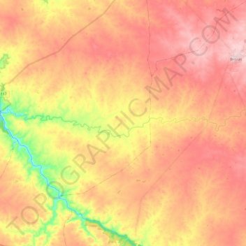
Name: Arroyo Jumadiel topographic map, elevation, terrain.
Average elevation: 313 m
Minimum elevation: 151 m
Maximum elevation: 418 m
Other topographic maps
Click on a map to view its topography, its elevation and its terrain.
Horno Tejero
España > Extremadura > Alcántara
Horno Tejero, Alcántara, Tajo-Salor, Cáceres, Extremadura, 10980, España
Average elevation: 270 m
Alcántara
España > Extremadura > Alcántara
Alcántara, Tajo-Salor, Cáceres, Extremadura, 10980, España
Average elevation: 240 m