Geolocate

Sijantung topographic map

Click on the map to display elevation.

About this map

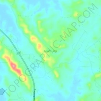
Name: Sijantung topographic map, elevation, terrain.

Location: Sijantung, Batam, Riau Islands, Sumatra, 29481, Indonesia (0.73541 104.19204 0.77541 104.23204)

Average elevation: 24 m

Minimum elevation: 0 m

Maximum elevation: 116 m

Other topographic maps

Click on a map to view its topography, its elevation and its terrain.

Sungai Kecil

Indonesia > Riau Islands > Batam > Batu Aji

Average elevation: 25 m

Gear up for your next adventure:

🥾Mountain Hiking Boots - High-traction boots for rocky terrain
🥾Light Trekking Boots - Supportive boots for multi-day treks
💡LED Headlamp - Hands-free illumination for night hiking and camping
🧭GPS Outdoor Watch - Smart watch for navigation and fitness tracking in nature
🧦Hiking Liner Socks - Thin base layer to prevent friction and blisters

As an Amazon Associate, this site earns from qualifying purchases at no extra cost to you.