Geolocate

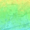
Lainate topographic map

Click on the map to display elevation.

About this map

Name: Lainate topographic map, elevation, terrain.

Location: Lainate, Milano, Lombardia, 20045, Italia (45.54102 8.99541 45.58850 9.05593)

Average elevation: 177 m

Minimum elevation: 157 m

Maximum elevation: 200 m

Other topographic maps

Click on a map to view its topography, its elevation and its terrain.

San Pietro all'Olmo

Italia > Lombardia > Milano > Cornaredo

Average elevation: 142 m

Milano 3

Italia > Lombardia > Milano

Average elevation: 100 m

Molino Ortolina

Italia > Lombardia > Milano > Pioltello

Average elevation: 123 m

Malvaglio

Italia > Lombardia > Milano > Robecchetto con Induno

Average elevation: 160 m

Monluè

Italia > Lombardia > Milano > Milano

Average elevation: 112 m

Cascina Villa

Italia > Lombardia > Milano > Lainate

Average elevation: 166 m

Gear up for your next adventure:

🧥Thermal Fleece Jacket - Versatile insulation for changing mountain temperatures
🥾Waterproof Hiking Boots - Essential footwear for rugged terrain and wet Canadian trails
💡Compact LED Flashlight - Powerful and portable flashlight for outdoor use
🧢Beanie Hat - Keep your head warm in cold weather
🧦Outdoor Socks - Durable socks designed for hiking and outdoor sports

As an Amazon Associate, this site earns from qualifying purchases at no extra cost to you.