Geolocate

Stukely-Sud topographic map

Click on the map to display elevation.

About this map
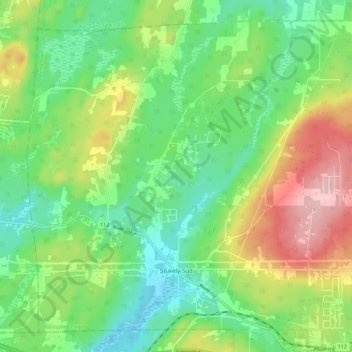
Name: Stukely-Sud topographic map, elevation, terrain.

Location: Stukely-Sud, Memphrémagog, Estrie, Quebec, J0E 2J0, Canada (45.30745 -72.46592 45.37705 -72.35421)

Average elevation: 281 m

Minimum elevation: 216 m

Maximum elevation: 395 m

Gear up for your next adventure:

👟Leg Gaiters - Keep debris, mud, and snow out of your boots
🛶Kayak Dry Bag - Waterproof storage for kayaking adventures
🥾Trekking Boots - Durable boots for long-distance trekking
🌬️Windproof Camp Stove - Efficient cooking even on exposed mountain peaks
⛺Bushcraft Tarp - Versatile emergency shelter or gear protection

As an Amazon Associate, this site earns from qualifying purchases at no extra cost to you.