Geolocate

Lono topographic map

Click on the map to display elevation.

About this map

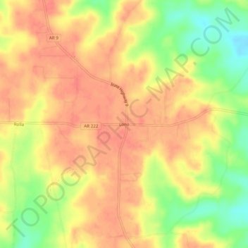
Name: Lono topographic map, elevation, terrain.

Location: Lono, Hot Spring County, Arkansas, United States (34.18815 -92.73016 34.22815 -92.69016)

Average elevation: 141 m

Minimum elevation: 104 m

Maximum elevation: 161 m

Other topographic maps

Click on a map to view its topography, its elevation and its terrain.

Malvern

United States > Arkansas > Hot Spring County

Average elevation: 101 m

Malvern

United States > Arkansas > Hot Spring County

Average elevation: 101 m

Gear up for your next adventure:

🛶Kayak Dry Bag - Waterproof storage for kayaking adventures
🔦LED Flashlight - Powerful and long-lasting flashlight for camping and emergencies
🛌Down Sleeping Bag - Superior warmth-to-weight ratio for cold nights
🧭GPS Outdoor Watch - Smart watch for navigation and fitness tracking in nature
🧦Outdoor Socks - Durable socks designed for hiking and outdoor sports

As an Amazon Associate, this site earns from qualifying purchases at no extra cost to you.