
Thank you for supporting this site ❤️
Make a donation
Make a donation
Gear up for your next adventure:
As an Amazon Associate, this site earns from qualifying purchases at no extra cost to you.
Dalaas topographic map
Click on the map to display elevation.
Thank you for supporting this site ❤️
Make a donation
Make a donation
Gear up for your next adventure:
As an Amazon Associate, this site earns from qualifying purchases at no extra cost to you.
About this map
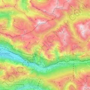
Name: Dalaas topographic map, elevation, terrain.
Location: Dalaas, Bezirk Bludenz, Vorarlberg, 6752, Austria (47.10228 9.95094 47.20908 10.13898)
Average elevation: 1,681 m
Minimum elevation: 666 m
Maximum elevation: 2,670 m
Thank you for supporting this site ❤️
Make a donation
Make a donation
Gear up for your next adventure:
As an Amazon Associate, this site earns from qualifying purchases at no extra cost to you.