
Thank you for supporting this site ❤️
Make a donation
Make a donation
Gear up for your next adventure:
As an Amazon Associate, this site earns from qualifying purchases at no extra cost to you.
6108 topographic map
Click on the map to display elevation.
Thank you for supporting this site ❤️
Make a donation
Make a donation
Gear up for your next adventure:
As an Amazon Associate, this site earns from qualifying purchases at no extra cost to you.
About this map
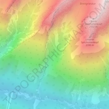
Name: 6108 topographic map, elevation, terrain.
Location: 6108, Scharnitz, Bezirk Innsbruck-Land, Tirol, Österreich (47.38797 11.36673 47.38807 11.36683)
Average elevation: 1,681 m
Minimum elevation: 1,060 m
Maximum elevation: 2,536 m
Thank you for supporting this site ❤️
Make a donation
Make a donation
Gear up for your next adventure:
As an Amazon Associate, this site earns from qualifying purchases at no extra cost to you.