
Thank you for supporting this site ❤️
Make a donation
Make a donation
Gear up for your next adventure:
As an Amazon Associate, this site earns from qualifying purchases at no extra cost to you.
Muñochas topographic map
Click on the map to display elevation.
Thank you for supporting this site ❤️
Make a donation
Make a donation
Gear up for your next adventure:
As an Amazon Associate, this site earns from qualifying purchases at no extra cost to you.
About this map
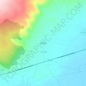
Name: Muñochas topographic map, elevation, terrain.
Location: Muñochas, Padiernos, Ávila, Castilië en León, 05530, Spanje (40.59666 -4.89108 40.63666 -4.85108)
Average elevation: 1,167 m
Minimum elevation: 1,090 m
Maximum elevation: 1,407 m
Thank you for supporting this site ❤️
Make a donation
Make a donation
Gear up for your next adventure:
As an Amazon Associate, this site earns from qualifying purchases at no extra cost to you.