Geolocate

Columbus topographic map

Click on the map to display elevation.

Columbus

The city lies at an elevation of 1,447 feet (441 m). It is built on the flat terrain of the Platte River valley; rolling hills rise to the north of the city.

Wikipedia (CC-BY-SA 3.0)

About this map

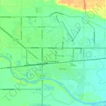
Name: Columbus topographic map, elevation, terrain.

Location: Columbus, Platte County, Nebraska, United States (41.40238 -97.39830 41.46771 -97.29998)

Average elevation: 442 m

Minimum elevation: 431 m

Maximum elevation: 469 m

Gear up for your next adventure:

🧣Merino Neck Gaiter - Protects against wind, sun, and cold at high altitudes
🚲Handlebar Phone Mount - View topographic-map.com live while cycling
💧Reusable Water Bottle - Durable water bottles for hydration on trails
🛌Insulated Sleeping Pad - Critical thermal barrier between you and the cold ground
🛏️Sleeping Bag - Warm and compact sleeping bags for outdoor camping

As an Amazon Associate, this site earns from qualifying purchases at no extra cost to you.