
Thank you for supporting this site ❤️
Make a donation
Make a donation
Gear up for your next adventure:
As an Amazon Associate, this site earns from qualifying purchases at no extra cost to you.
Cuestecitas topographic map
Click on the map to display elevation.
Thank you for supporting this site ❤️
Make a donation
Make a donation
Gear up for your next adventure:
As an Amazon Associate, this site earns from qualifying purchases at no extra cost to you.
About this map
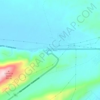
Name: Cuestecitas topographic map, elevation, terrain.
Location: Cuestecitas, Albania, La Guajira, RAP Caribe, Colombia (11.16133 -72.63814 11.20133 -72.59814)
Average elevation: 140 m
Minimum elevation: 83 m
Maximum elevation: 416 m
Thank you for supporting this site ❤️
Make a donation
Make a donation
Gear up for your next adventure:
As an Amazon Associate, this site earns from qualifying purchases at no extra cost to you.