Geolocate

Ardales topographic map

Click on the map to display elevation.

About this map
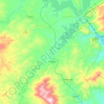
Name: Ardales topographic map, elevation, terrain.

Location: Ardales, Guadalteba, Malaga, Andalusia, 29550, Spain (36.84227 -4.93904 36.93970 -4.76267)

Average elevation: 517 m

Minimum elevation: 172 m

Maximum elevation: 1,281 m

Gear up for your next adventure:

🪑Insulated Seat Pad - Protect your seat from cold rocks and wet logs
🧢Hiking Hat - Sun-protective and breathable hats for long treks
🥾Trekking Poles - Adjustable trekking poles to reduce knee stress and improve stability
🥾Durable Hiking Shoes - Long-lasting shoes for frequent hiking
🧥Thermal Fleece Jacket - Versatile insulation for changing mountain temperatures

As an Amazon Associate, this site earns from qualifying purchases at no extra cost to you.