
Thank you for supporting this site ❤️
Make a donation
Make a donation
Gear up for your next adventure:
As an Amazon Associate, this site earns from qualifying purchases at no extra cost to you.
Sipora topographic map
Click on the map to display elevation.
Thank you for supporting this site ❤️
Make a donation
Make a donation
Gear up for your next adventure:
As an Amazon Associate, this site earns from qualifying purchases at no extra cost to you.
About this map
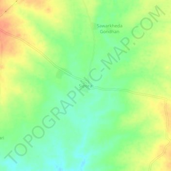
Name: Sipora topographic map, elevation, terrain.
Location: Sipora, Jafferabad, Jalna District, Maharashtra, 431208, Inde (20.19091 76.07503 20.23091 76.11503)
Average elevation: 540 m
Minimum elevation: 519 m
Maximum elevation: 562 m
Thank you for supporting this site ❤️
Make a donation
Make a donation
Gear up for your next adventure:
As an Amazon Associate, this site earns from qualifying purchases at no extra cost to you.