Geolocate

Chagual topographic map

Click on the map to display elevation.

About this map

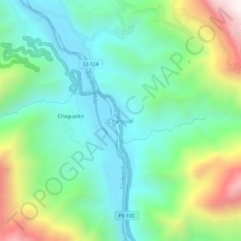
Name: Chagual topographic map, elevation, terrain.

Location: Chagual, Patáz, Province of Pataz, La Libertad, Peru (-7.85251 -77.65459 -7.81251 -77.61459)

Average elevation: 1,568 m

Minimum elevation: 1,218 m

Maximum elevation: 2,403 m

Gear up for your next adventure:

🧊Portable Cooler - Keep food and drinks cold during outdoor adventures
🪑Insulated Seat Pad - Protect your seat from cold rocks and wet logs
🔥Camping Stove - Portable stoves to cook outdoors with ease
🧦Outdoor Socks - Durable socks designed for hiking and outdoor sports
🧦Hiking Liner Socks - Thin base layer to prevent friction and blisters

As an Amazon Associate, this site earns from qualifying purchases at no extra cost to you.