Geolocate

Yadan topographic map

Click on the map to display elevation.

About this map

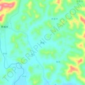
Name: Yadan topographic map, elevation, terrain.

Location: Yadan, Guilin, Guangxi, China (24.46210 110.24003 24.50210 110.28003)

Average elevation: 239 m

Minimum elevation: 195 m

Maximum elevation: 368 m

Other topographic maps

Click on a map to view its topography, its elevation and its terrain.

Pingle County

China > Guangxi > Guilin

Average elevation: 390 m

Xiangshan District

China > Guangxi > Guilin

Average elevation: 179 m

Yangshuo County

China > Guangxi > Guilin

Average elevation: 319 m

Yangshuo County

China > Guangxi > Guilin

Average elevation: 319 m

Gear up for your next adventure:

🥾Waterproof Trail Shoes - Shoes designed to handle wet terrain
🥾Hiking Shoes - Durable and comfortable shoes for trail hiking
🧤Rechargeable Heated Gloves - Extreme warmth for Canadian winter expeditions
❄️Traction Ice Cleats - Slip-on spikes for icy trails and winter hiking
🔭Outdoor Binoculars - Lightweight binoculars for birdwatching and hiking

As an Amazon Associate, this site earns from qualifying purchases at no extra cost to you.