Geolocate

Burgos topographic map

Click on the map to display elevation.

About this map

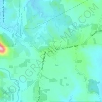
Name: Burgos topographic map, elevation, terrain.

Location: Burgos, San Jose, Tarlac, Central Luzon, 2318, Philippines (15.47438 120.38341 15.51438 120.42341)

Average elevation: 157 m

Minimum elevation: 108 m

Maximum elevation: 389 m

Other topographic maps

Click on a map to view its topography, its elevation and its terrain.

Bulsa River

Philippines > Tarlac > San Jose

Average elevation: 99 m

Gear up for your next adventure:

🛌Down Sleeping Bag - Superior warmth-to-weight ratio for cold nights
🏃Hydration Running Vest - Carry water and maps close to your body for speed
🎒Hiking Backpack - Lightweight and ergonomic backpacks for day hikes or multi-day treks
🥾Hiking Leggings - Comfortable leggings for outdoor activities
💡LED Headlamp - Hands-free illumination for night hiking and camping

As an Amazon Associate, this site earns from qualifying purchases at no extra cost to you.