Geolocate

Pedakakani topographic map

Click on the map to display elevation.

About this map

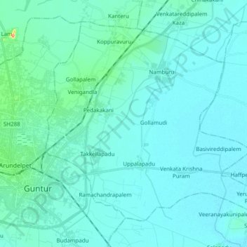
Name: Pedakakani topographic map, elevation, terrain.

Location: Pedakakani, Guntur, Andhra Pradesh, 522509, India (16.26952 80.45889 16.38973 80.61051)

Average elevation: 22 m

Minimum elevation: 10 m

Maximum elevation: 131 m

Other topographic maps

Click on a map to view its topography, its elevation and its terrain.

Pedakakani

India > Andhra Pradesh > Pedakakani

Average elevation: 26 m

Gear up for your next adventure:

🦟Insect Repellent - Keep mosquitoes and black flies away in wooded areas
🥾Hiking Leggings - Comfortable leggings for outdoor activities
Camping Groundsheet - Protect your tent from moisture and dirt
🚲Bike Repair Kit - Essential tools for on-trail mechanical issues
🧣Merino Neck Gaiter - Protects against wind, sun, and cold at high altitudes

As an Amazon Associate, this site earns from qualifying purchases at no extra cost to you.