Geolocate

Dousman topographic map

Click on the map to display elevation.

About this map

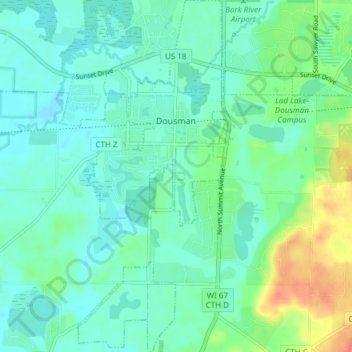
Name: Dousman topographic map, elevation, terrain.

Location: Dousman, Waukesha County, Wisconsin, United States (42.97793 -88.49758 43.03309 -88.46110)

Average elevation: 269 m

Minimum elevation: 255 m

Maximum elevation: 313 m

Other topographic maps

Click on a map to view its topography, its elevation and its terrain.

Lapham Hill

United States > Wisconsin > Waukesha County

Average elevation: 314 m

Eagleville

United States > Wisconsin > Waukesha County

Average elevation: 262 m

Gear up for your next adventure:

🛶Canoe Life Vest - Safety vest for water sports
🧤Rechargeable Heated Gloves - Extreme warmth for Canadian winter expeditions
🧢Outdoor Visor - Breathable visor for sunny hikes
👟Sport Hiking Sandals - Breathable footwear for water crossings and camp rest
🔋Emergency Crank Radio - Weather alerts and power without needing batteries

As an Amazon Associate, this site earns from qualifying purchases at no extra cost to you.