Geolocate

Ingham topographic map

Click on the map to display elevation.

About this map

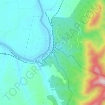
Name: Ingham topographic map, elevation, terrain.

Location: Ingham, Page County, Virginia, 22849, United States (38.50901 -78.59807 38.54901 -78.55807)

Average elevation: 361 m

Minimum elevation: 248 m

Maximum elevation: 728 m

Gear up for your next adventure:

👟Trail Running Shoes - Agile footwear for fast-paced topographic exploration
🪑Insulated Seat Pad - Protect your seat from cold rocks and wet logs
🧦Merino Wool Socks - Moisture-wicking comfort for long-distance hiking
🛶Waterproof Dry Bags - Keep electronics and clothes dry during river crossings
🧼Biodegradable Camp Soap - Environmentally friendly cleaning for gear and body

As an Amazon Associate, this site earns from qualifying purchases at no extra cost to you.