Geolocate

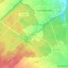
Tardais topographic map

Click on the map to display elevation.

About this map

Name: Tardais topographic map, elevation, terrain.

Location: Tardais, Senonches, Dreux, Eure-et-Loir, Centre-Val de Loire, France métropolitaine, 28250, France (48.57224 0.99362 48.58399 1.01541)

Average elevation: 232 m

Minimum elevation: 211 m

Maximum elevation: 258 m

Other topographic maps

Click on a map to view its topography, its elevation and its terrain.
Tardais

France > Centre-Val de Loire > Eure-et-Loir > Senonches > Tardais

Average elevation: 231 m

Gear up for your next adventure:

💡Portable Camping Lamp - Rechargeable lamp for campsite lighting
🕶️Polarized Sunglasses - Protect your eyes with durable polarized lenses
⛺Lightweight Backpacking Tent - Compact tent for efficient hiking trips
💡LED Camping Lantern - Illuminate your campsite with long-lasting lanterns
🥤Collapsible Travel Cup - Saves space and weight in your mess kit

As an Amazon Associate, this site earns from qualifying purchases at no extra cost to you.