Geolocate

Marsella topographic map

Click on the map to display elevation.

About this map

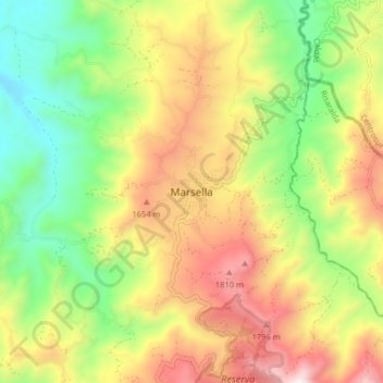
Name: Marsella topographic map, elevation, terrain.

Location: Marsella, Risaralda, Región Andina, 66440, Colombia (4.89676 -75.77904 4.97676 -75.69904)

Average elevation: 1,387 m

Minimum elevation: 901 m

Maximum elevation: 1,988 m

Gear up for your next adventure:

💡LED Headlamp - Hands-free illumination for night hiking and camping
💧Hydration Bladder - Hands-free hydration solution for long treks
🏃Hydration Running Vest - Carry water and maps close to your body for speed
🧦Crew Hiking Socks - Comfortable socks for long-distance hikes
🥾Mountain Hiking Boots - High-traction boots for rocky terrain

As an Amazon Associate, this site earns from qualifying purchases at no extra cost to you.