Geolocate

Chontabamba topographic map

Click on the map to display elevation.

About this map

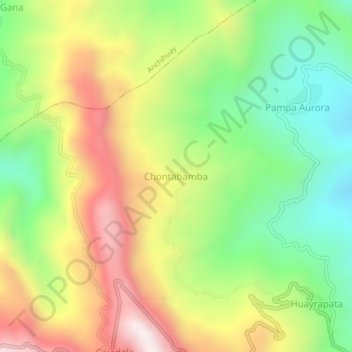
Name: Chontabamba topographic map, elevation, terrain.

Location: Chontabamba, Anco, Provincia de La Mar, Ayacucho, Perú (-12.94232 -73.59936 -12.90232 -73.55936)

Average elevation: 1,434 m

Minimum elevation: 1,037 m

Maximum elevation: 1,935 m

Gear up for your next adventure:

🧥Thermal Fleece Jacket - Versatile insulation for changing mountain temperatures
🧤Rechargeable Heated Gloves - Extreme warmth for Canadian winter expeditions
🧤Insulated Winter Gloves - Heavy-duty protection for sub-zero Canadian adventures
🛶Waterproof Dry Bags - Keep electronics and clothes dry during river crossings
🔥Camping Stove - Portable stoves to cook outdoors with ease

As an Amazon Associate, this site earns from qualifying purchases at no extra cost to you.