Geolocate

Clos Notre-dame topographic map

Click on the map to display elevation.

About this map
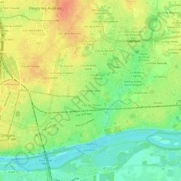
Name: Clos Notre-dame topographic map, elevation, terrain.

Location: Clos Notre-dame, Orléans, Loiret, Centre-Val de Loire, France métropolitaine, 45400, France (47.89262 1.91585 47.93262 1.95585)

Average elevation: 110 m

Minimum elevation: 86 m

Maximum elevation: 133 m

Other topographic maps

Click on a map to view its topography, its elevation and its terrain.

45000

France > Centre-Val de Loire > Loiret > Orléans > Cité Emile Zola

Average elevation: 112 m

Gear up for your next adventure:

🦌Outdoor Trail Camera - Monitor wildlife activity near your favorite spots
🥾Lightweight Hiking Shoes - Comfortable shoes for day hikes
🧢Hiking Sun Hat - Wide-brimmed protection for exposed mountain ridges
🧤Rechargeable Heated Gloves - Extreme warmth for Canadian winter expeditions
⛺Lightweight Backpacking Tent - Compact tent for efficient hiking trips

As an Amazon Associate, this site earns from qualifying purchases at no extra cost to you.