Geolocate

Shayar topographic map

Click on the map to display elevation.

About this map

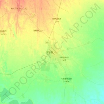
Name: Shayar topographic map, elevation, terrain.

Location: Shayar, Shayar County, Aksu Prefecture, Xinjiang, China (41.06177 82.60641 41.38177 82.92641)

Average elevation: 978 m

Minimum elevation: 963 m

Maximum elevation: 1,000 m

Gear up for your next adventure:

🎒Hiking Daypack - Lightweight and durable backpacks for day trips and excursions
🛌Down Sleeping Bag - Superior warmth-to-weight ratio for cold nights
🧥Insulated Jacket - Keep warm in cold outdoor conditions
🛶Waterproof Dry Bags - Keep electronics and clothes dry during river crossings
❄️Traction Ice Cleats - Slip-on spikes for icy trails and winter hiking

As an Amazon Associate, this site earns from qualifying purchases at no extra cost to you.