Geolocate

Crossroads topographic map

Click on the map to display elevation.

About this map

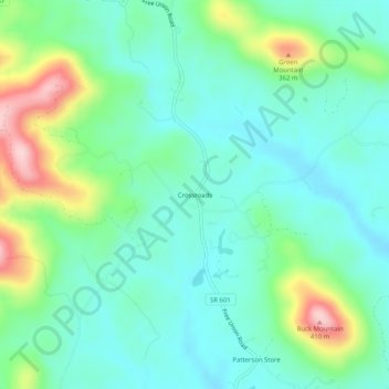
Name: Crossroads topographic map, elevation, terrain.

Location: Crossroads, Albemarle County, Virginia, 22940, United States (38.18652 -78.60002 38.22652 -78.56002)

Average elevation: 225 m

Minimum elevation: 158 m

Maximum elevation: 411 m

Gear up for your next adventure:

🥾Waterproof Hiking Boots - Boots keeping your feet dry in wet conditions
🧊Portable Cooler - Keep food and drinks cold during outdoor adventures
Family Camping Tent - Spacious tent suitable for family camping trips
🥾Light Trekking Boots - Supportive boots for multi-day treks
🚲MTB Frame Bag - Carry tools and maps directly on your bicycle frame

As an Amazon Associate, this site earns from qualifying purchases at no extra cost to you.