
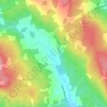
Albert Mines topographic map
Interactive map
Click on the map to display elevation.
About this map
Name: Albert Mines topographic map, elevation, terrain.
Average elevation: 113 m
Minimum elevation: 49 m
Maximum elevation: 182 m
Other topographic maps
Click on a map to view its topography, its elevation and its terrain.
Hillsborough
Canada > New Brunswick > Hillsborough Parish
Hillsborough, Hillsborough Parish, Albert County, New Brunswick, Canada
Average elevation: 26 m