Geolocate

Moldoveanu topographic map

Click on the map to display elevation.

About this map

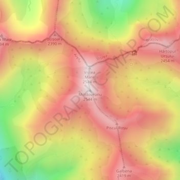
Name: Moldoveanu topographic map, elevation, terrain.

Location: Moldoveanu, Nucșoara, Argeș, Romania (45.59951 24.73612 45.59961 24.73622)

Average elevation: 2,142 m

Minimum elevation: 1,570 m

Maximum elevation: 2,520 m

Gear up for your next adventure:

🧢Outdoor Visor - Breathable visor for sunny hikes
🛌Insulated Sleeping Pad - Critical thermal barrier between you and the cold ground
🥾Hiking Gaiters - Protect legs and shoes from mud, snow, and debris
🔋Solar Power Bank - Keep your GPS and devices charged during long outdoor trips
💧Hydration Pack - Hands-free hydration system for long hikes

As an Amazon Associate, this site earns from qualifying purchases at no extra cost to you.