Geolocate

Laraqueri topographic map

Click on the map to display elevation.

About this map

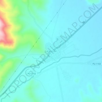
Name: Laraqueri topographic map, elevation, terrain.

Location: Laraqueri, Pichacani, Province of Puno, Puno, Peru (-16.16972 -70.08359 -16.12972 -70.04359)

Average elevation: 3,973 m

Minimum elevation: 3,926 m

Maximum elevation: 4,237 m

Gear up for your next adventure:

🏃Hydration Running Vest - Carry water and maps close to your body for speed
🧥Packable Rain Jacket - Breathable waterproof layer for unpredictable weather
🔦LED Flashlight - Powerful and long-lasting flashlight for camping and emergencies
🥾Lightweight Hiking Boots - Boots for comfort and mobility on long hikes
🥾Hiking Shoes - Durable and comfortable shoes for trail hiking

As an Amazon Associate, this site earns from qualifying purchases at no extra cost to you.