
Thank you for supporting this site ❤️
Make a donation
Make a donation
Gear up for your next adventure:
As an Amazon Associate, this site earns from qualifying purchases at no extra cost to you.
Inguias topographic map
Click on the map to display elevation.
Thank you for supporting this site ❤️
Make a donation
Make a donation
Gear up for your next adventure:
As an Amazon Associate, this site earns from qualifying purchases at no extra cost to you.
About this map
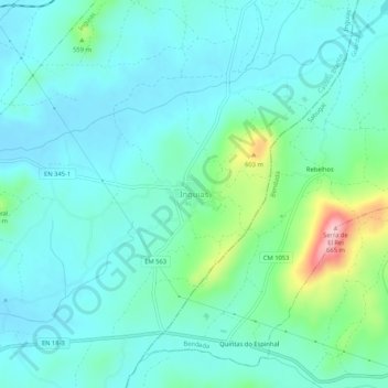
Name: Inguias topographic map, elevation, terrain.
Location: Inguias, Belmonte, Castelo Branco, 6250-162, Portugal (40.30555 -7.31631 40.34555 -7.27631)
Average elevation: 492 m
Minimum elevation: 452 m
Maximum elevation: 658 m
Thank you for supporting this site ❤️
Make a donation
Make a donation
Gear up for your next adventure:
As an Amazon Associate, this site earns from qualifying purchases at no extra cost to you.