Geolocate

Pilcos topographic map

Click on the map to display elevation.

About this map

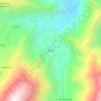
Name: Pilcos topographic map, elevation, terrain.

Location: Pilcos, Colcabamba, Tayacaja, Huancavelica, Perú (-12.41803 -74.67656 -12.37803 -74.63656)

Average elevation: 2,781 m

Minimum elevation: 2,200 m

Maximum elevation: 3,710 m

Gear up for your next adventure:

💡Portable Camping Lamp - Rechargeable lamp for campsite lighting
👟Sport Hiking Sandals - Breathable footwear for water crossings and camp rest
🧴First Aid Kit - Essential first aid supplies for outdoor emergencies
🧥Waterproof Pants - Keep dry during rainy hiking conditions
🧭Orienteering Kit - Tools for map reading and navigation in the wild

As an Amazon Associate, this site earns from qualifying purchases at no extra cost to you.