
Thank you for supporting this site ❤️
Make a donation
Make a donation
Gear up for your next adventure:
As an Amazon Associate, this site earns from qualifying purchases at no extra cost to you.
Sornico topographic map
Click on the map to display elevation.
Thank you for supporting this site ❤️
Make a donation
Make a donation
Gear up for your next adventure:
As an Amazon Associate, this site earns from qualifying purchases at no extra cost to you.
About this map
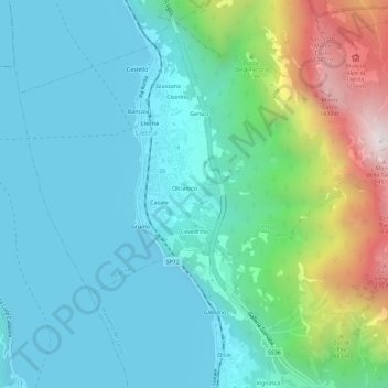
Name: Sornico topographic map, elevation, terrain.
Location: Sornico, Lierna, Lecco, Lombardy, 23827, Italy (45.93281 9.28962 45.97281 9.32962)
Average elevation: 487 m
Minimum elevation: 188 m
Maximum elevation: 1,518 m
Thank you for supporting this site ❤️
Make a donation
Make a donation
Gear up for your next adventure:
As an Amazon Associate, this site earns from qualifying purchases at no extra cost to you.