Geolocate

Rothaurach topographic map

Click on the map to display elevation.

About this map

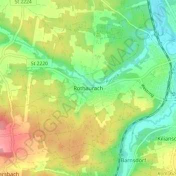
Name: Rothaurach topographic map, elevation, terrain.

Location: Rothaurach, Roth, Landkreis Roth, Bayern, 91186, Deutschland (49.21945 11.03431 49.25945 11.07431)

Average elevation: 365 m

Minimum elevation: 324 m

Maximum elevation: 421 m

Gear up for your next adventure:

🦶Hiking Shoe Insoles - Added support for high arches and long days on feet
Bushcraft Tarp - Versatile emergency shelter or gear protection
🛶Waterproof Dry Bags - Keep electronics and clothes dry during river crossings
🛏️Sleeping Bag - Warm and compact sleeping bags for outdoor camping
🥾Hiking Leggings - Comfortable leggings for outdoor activities

As an Amazon Associate, this site earns from qualifying purchases at no extra cost to you.