Geolocate

Crestline topographic map

Click on the map to display elevation.

About this map

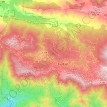
Name: Crestline topographic map, elevation, terrain.

Location: Crestline, San Bernardino County, California, 92322, United States (34.22295 -117.34269 34.27617 -117.24840)

Average elevation: 1,301 m

Minimum elevation: 661 m

Maximum elevation: 1,727 m

Other topographic maps

Click on a map to view its topography, its elevation and its terrain.

Gear up for your next adventure:

🧊Insulated Water Bottle - Keeps drinks cold in summer and prevents freezing in winter
🔥Emergency Fire Starter - Reliable ignition source for all weather conditions
Tent Footprint - Protect tent floor and increase durability
🧶550 Survival Paracord - Versatile utility cord for emergency repairs and rigging
🧰Multitool Knife - Compact and versatile tool for outdoor use

As an Amazon Associate, this site earns from qualifying purchases at no extra cost to you.