Geolocate

Transvaal topographic map

Click on the map to display elevation.

About this map

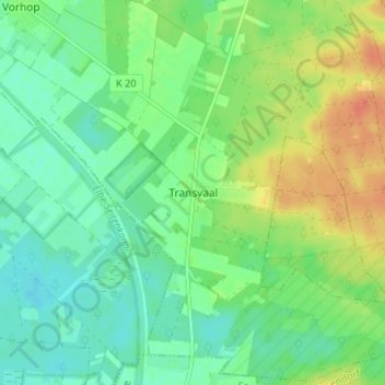
Name: Transvaal topographic map, elevation, terrain.

Location: Transvaal, Wittingen, Gifhorn, Lower Saxony, 29379, Germany (52.60344 10.66915 52.64344 10.70915)

Average elevation: 72 m

Minimum elevation: 57 m

Maximum elevation: 96 m

Other topographic maps

Click on a map to view its topography, its elevation and its terrain.

29379

Germany > Lower Saxony > Gifhorn > Wittingen

Average elevation: 74 m

Gear up for your next adventure:

👟Sport Hiking Sandals - Breathable footwear for water crossings and camp rest
🕯️Camping Lantern - Illuminates your entire campsite with high-efficiency LEDs
🥾Trekking Boots - Durable boots for long-distance trekking
🔦LED Headlamp - Hands-free lighting for early morning starts or late finishes
🚲Bike Repair Kit - Essential tools for on-trail mechanical issues

As an Amazon Associate, this site earns from qualifying purchases at no extra cost to you.