Geolocate

Zane topographic map

Click on the map to display elevation.

About this map

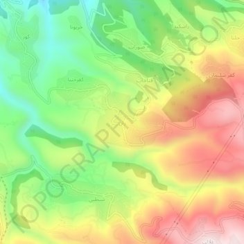
Name: Zane topographic map, elevation, terrain.

Location: Zane, Batroun District, North Governorate, 4231, Lebanon (34.20397 35.73564 34.24397 35.77564)

Average elevation: 545 m

Minimum elevation: 251 m

Maximum elevation: 879 m

Gear up for your next adventure:

🧭GPS Handheld Device - Reliable GPS navigation for outdoor adventures
🔭Compact Monocular - One-handed bird watching and trail spotting
🥽Outdoor Goggles - Protective eyewear for outdoor activities
🦯Trekking Poles - Reduced impact on joints for steep topographic climbs
Bushcraft Tarp - Versatile emergency shelter or gear protection

As an Amazon Associate, this site earns from qualifying purchases at no extra cost to you.