Geolocate

Diez topographic map

Click on the map to display elevation.

About this map
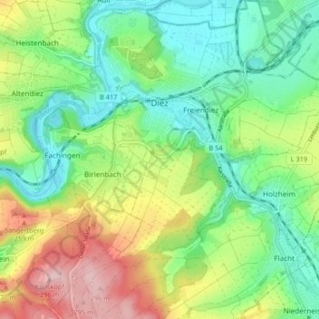
Name: Diez topographic map, elevation, terrain.

Location: Diez, Rhein-Lahn-Kreis, Rhineland-Palatinate, 65582, Germany (50.33398 7.99025 50.38613 8.06394)

Average elevation: 172 m

Minimum elevation: 100 m

Maximum elevation: 300 m

Other topographic maps

Click on a map to view its topography, its elevation and its terrain.

Gear up for your next adventure:

🧢Outdoor Cap - Protective cap for sun and rain during hikes
🥾Trail Hiking Socks - Comfortable socks to prevent blisters and fatigue
🧊Insulated Water Bottle - Keeps drinks cold in summer and prevents freezing in winter
👟Leg Gaiters - Keep debris, mud, and snow out of your boots
🥾Hiking Leggings - Comfortable leggings for outdoor activities

As an Amazon Associate, this site earns from qualifying purchases at no extra cost to you.