Geolocate

Dinwiddie topographic map

Click on the map to display elevation.

About this map

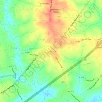
Name: Dinwiddie topographic map, elevation, terrain.

Location: Dinwiddie, Dinwiddie County, Virginia, 23841, United States (37.05793 -77.60666 37.09793 -77.56666)

Average elevation: 65 m

Minimum elevation: 36 m

Maximum elevation: 96 m

Other topographic maps

Click on a map to view its topography, its elevation and its terrain.

Gear up for your next adventure:

🧰Emergency Multi-Tool - Compact multi-tool for outdoor survival
🥘Camping Cookware Set - Compact nesting pots and pans for trail cooking
🧭GPS Tracker - Track your location in remote areas safely
🥾Light Hiking Boots - Lightweight and comfortable boots for day hikes
🧢Hiking Hat - Sun-protective and breathable hats for long treks

As an Amazon Associate, this site earns from qualifying purchases at no extra cost to you.